This page may contain affiliate links, see our disclaimer here.
E4 European Walking Path in Crete
By Katia Luz
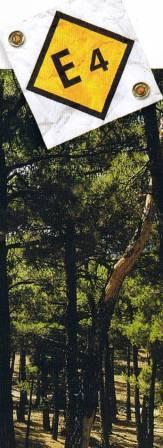
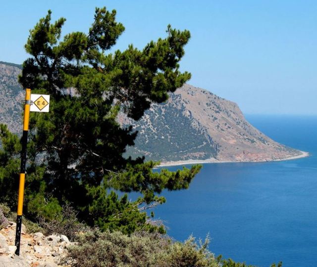 The E4 European Walking Path - Sign in South Crete
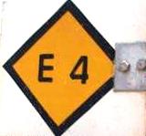
The E4 European Walking Path is a strolling, walking, hiking and trekking path that begins in Tarifa in Spain and ends in Cyprus in Greece. The whole path is 10,450 km long, created by the European Ramblers Association and marked (in some places) by yellow markers.
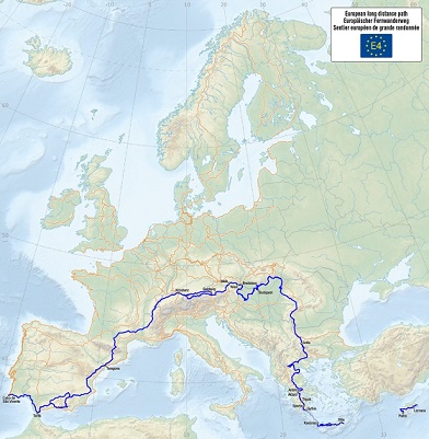

The European Ramblers Association (ERA) is an umbrella
organisation for over 55 rambler’s associations across Europe and was
formed in 1969. It participates in the Council of Europe as a
non-government organisation.
In Greece the E4 path is looked after by the Hellenic Federation of Mountaineering and Climbing and their website is www.eooa.gr
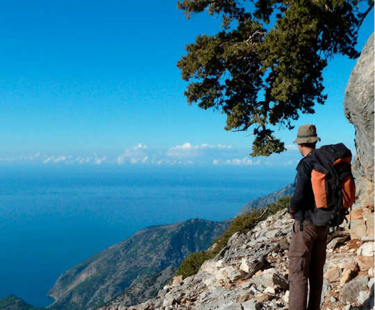
The E4 track in Crete is 320 km in total, beginning at Kastelli-Kissamos in the west and ending at Kato Zakros in the east. The path takes in some of the most beautiful scenery and interesting hiking country in Crete, it is a hard path with a choice between an alpine section and coastal section and is for experienced trekkers.
Really it is not organised, like most walking in Crete and you must be careful, as there are not complete trails and not always signage. Always ask the locals before you walk, always walk with a group.
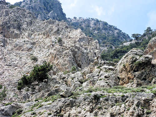 Rouvas Gorge, Central Crete
E4 European Walking Path in Crete
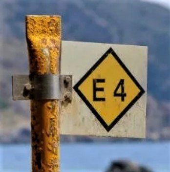
Here on our website, we have touched on many places that include the E4 track. Of course if you are not walking the whole track, you can take some of the trails on your visits to different parts of the island.
Starting in the West
The path leads from Kastelli-Kissamos south through Elafonisi and Paleochora and Sougia. This allows access to the Agia Irini Gorge (which would be a side trek off the path).
After Sougia, the path splits and walkers can choose between the alpine and coastal routes.
The alpine route takes walkers inland to the Lefka Ori mountains, the Omalos Plateau, and requires staying in refuges high in the White Mountains. This is the toughest section of the walk.
Hikers could choose to include the Samaria Gorge walk, which again would be a side path, and connect with the coastal path this way.
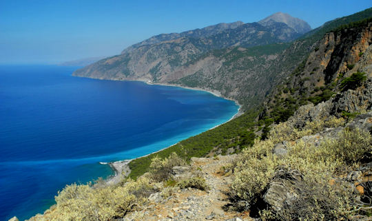 Agios Pavlos - east of Agia Roumeli, Chania
The coastal path continues along the southern coast of Chania from Sougia to Agia Roumeli (near Samaria), then on to Loutro and Chora Sfakion,
The Imbros Gorge is close by, and could be another good 'side-gorge'. (A cry from our walks, when we saw an unexpected gorge opening off our main gorge. The leaders would cry out to the laggers, "Side gorge!" and the challenge would be on!) Seriously, this is a full day walk and would need to be well planned.
The coastal route then continues to Frangokastello and Kato Rodakino, now in Rethymnon, where it turns inland and joins the alpine route in the centre of Rethymnon at Agios Konstantinos.
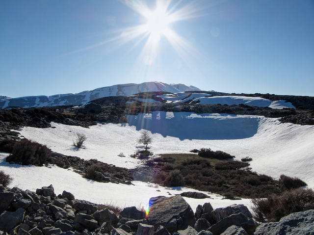
The paths cross here, but split up again, the alpine route crossing the lower hills of Rethymnon to Ameni, Arkadi, Garazo then into the Psiloritis Range to Anogia, Mt Ida, the highest mountain in Crete (pictured below), then on to the Nida Plateau near Zeus Cave,
From Heraklion to the East

Descending again from Nida through the Rouvas Gorge (pictured above) to the village of Zaros the track enters the Heraklion region, close by is the picturesque village of Kerasia, near Ano Asites on the way to Archanes Village.
Walking through farming country from Archanes to Moni Agarithou then to Kastamonitsa, the track makes it way up into the Lasithi Plateau to Agios Giorgos, in Lasithi.
The path goes through the Dikti Mountains, near Dikti Cave, skirts around the mountains to the Selekano Forest then to Prina, Vasiliki, Chrysopigi, Chandras to Ano Zakros through the Zakros Gorge, the 'Valley of the Dead' .
Hikers can put their feet up in the seaside town of Kato Zakros for a well-deserved rest. This is the end of the beautiful E4 European Walking Path.
Lasithi Section
The Lasithi section of the walk begins just east of Kastamonitsa below the Lasithi Plateau, the trail runs through the Lasithi Plateau and on to the Katharo Plateau in the Dikti Mountains.
Guidebook
This comprehensive guide includes detailed descriptions, maps, travelogue, GPS paths, accommodation information and hiking tips for trek, written in east to west format by Luca Gianotti, a world walking expert hiker with a passion for paths.
The Cretan Way is essential for those planning a serious walk along the Cretan section of the E4.
Guides and Hiking Maps
There does not seem to be a one stop hard copy map, or pack of maps, of the E4 European Walking Path in Crete. If anyone has found one, let us know! The Sunflower guides are really great general guides to Crete with good maps and the Anavasi hiking maps can be used for sections of the path.
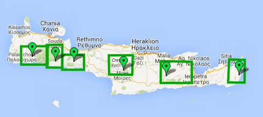
Anavasi have hiking maps of Crete which can be used for sections of the walk. They are all Topo25, that is 1:25,000. They can be purchased in digital or print format for approx.€9 each.
Shown in the diagram above from west to east the titles of the maps are - purchase hard copies below:
- Samaria - Sougia - Paleochora
- Lefka Ori - Sfakia / Pachnes
- Frangokastello - Plakias
- Mt Ida (Psiloritis)
- Mt Dikti - Mt Selena
- Zakros - Vai
Anavasi also have the 'Crete Adventure Atlas' at 1:50,000 specifically for the E4 Walk, at around €25.
Digital versions are available from anavasi.gr
A good place to get hard copy maps for touring and for use on the E4 European Walking Path in Crete and walking or hiking maps is Taxidiotiko Bibliopolio in Heraklion town.
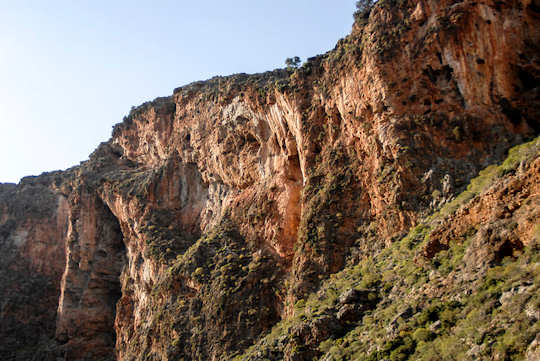 Zakros Gorge in east Crete - the E4 European Walking Path passes through this gorge
To Get Started
To commence the E4 European Walking Path
After you have done your research, prepared your equipment, trained and walked and hiked yourself into a good fitness level, taken that precious time away from home or work or other responsibilities, informed all your nearest and dearest, and packed your camera...you are ready to start!
Where to go? Of course you can begin where ever you like, there are a few blogs about the E4 in Crete which we suggest you consult...
If you want to start in the west and walk to the east, you will need to start in the town of Kastelli-Kissamos, at the north western tip of Crete.
To commence your E4 European Walking Path in Crete - you can do a comfortable day walk of around 7 km, from Kissamos to Polyrrinia.
To commence - go to the main square in Kissamos - which is named Eleftherios Venizelos Square - and is located on Iroon Polytechniou Street - in the centre of town.
The handy thing about this square is that the agency names Balos Travel is located right there, on the square, so you could visit the kind people there - perhaps the day before - to get all the maps and help you need for the walk, ask for Ioannis Kokkinakis, the manager.
Starting from Eleftherios Venizelos Square, walk east along Iroon Polytechniou Street, for approximately 300 metres, until a triangular intersection with a little park, opposite Cafe 42 and the petrol station, turn right into Polyrrinia Road, which is sign-posted to Kato Paleokastro, Grigoriana and Polyrrinia.
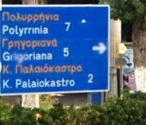
Walk to Polyrrinia, which is around 7 km, passing through the villages of Kato Palaiokastro and Grigoriana, then walk to the ancient archaeological site of Polyrrinia, on the acropolis to the east of the village. From here you will be able to admire the views back to Kastelli and over the Gulf of Kissamos.
Kalo Dromo! Good Luck on the Road!
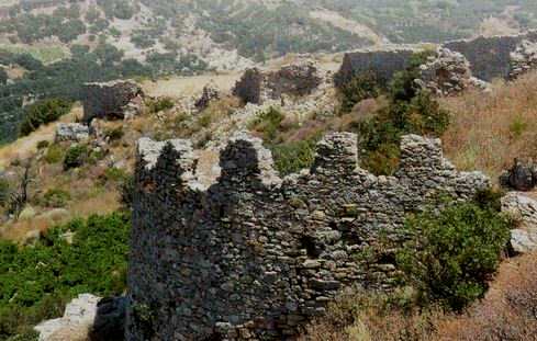 E4 European Walkign Path - Ruins of Polyrrinia
Take all your rubbish with and don't build any of those silly piles of rocks. Leave it as you found it and leave only footprints because We Love Crete!
Getting Here
Take a 1 hour flight from Athens to Heraklion with Aegean Airlines or Olympic Air, with many flights available per day.
Or take a 9.5 hour overnight ferry from Pireaus port of Athens to Heraklion port.
More on flights and ferries below.
Car hire in Crete is a really good idea as it is a large island 60 km by 260 km. There is so much to explore.
When you book with our car rental partners - Rental Centre Crete - you are supporting a local company with excellent service and easy online booking. We are sure you will be well looked after by the team. Choose from hybrid, electric or regular vehicles.

We trust you have enjoyed these tips from the We Love Crete team. Evíva!

Yiásas!
Anastasi, Apostoli & Katia
are the We Love Crete team
We just love sharing our passion for Crete, Greece and travel
About us Contact Us Kaló taxídi!
- Home
- Cretan Mountains
- E4 European Walking Path in Crete
About the Team
Yiásas!
Anastasi, Apostoli & Katia
are the
We Love Crete team
We just love sharing our passion for Crete, Greece and travel
About us
